Village map of Pierre & Vacances Cap Esterel
The park map and site plan of Pierre & Vacances Cap Esterel is not only very useful during your stay, but especially when booking. The map gives a clear overview of the available facilities and the location of the accommodations on the park. TIP: Book with preferred location and choose a cottage close to the main facilities.
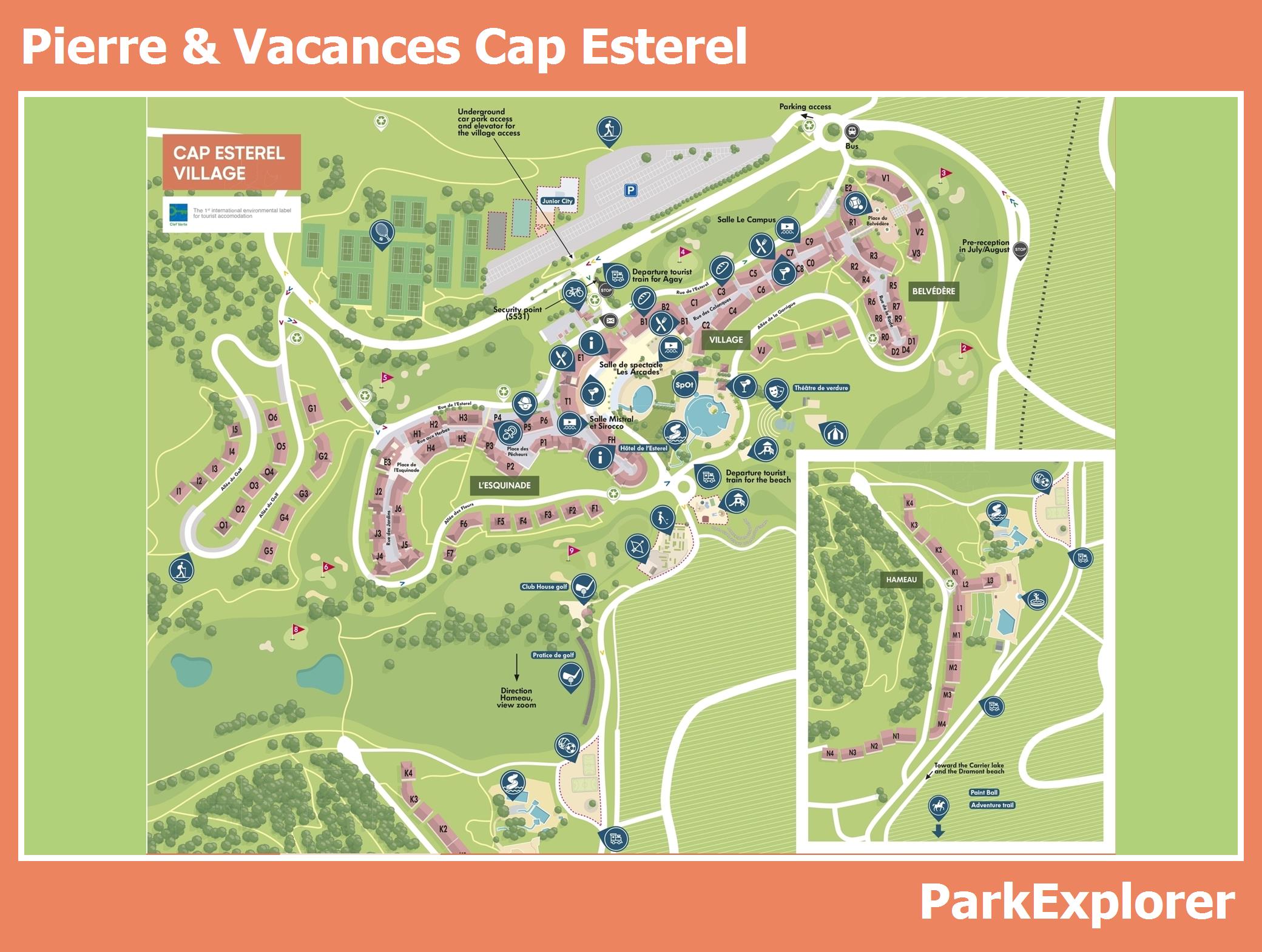
Cap Esterel is a car-free holiday village in the upper part of Saint-Raphaël, set in a 210-hectare green estate with the Esterel mountains as a backdrop and views over Agay Bay. The layout of the park is easy to follow: the Mediterranean-style apartments are divided into three districts, linked by a little land train in high season. The park map and site plan show that the facilities are spread throughout the village: four swimming pools, including a wave pool with slides and a paddling pool, plus shops, bars, restaurants, the 9-hole golf course, sports grounds, an adventure trail and the kids' clubs for children aged 3 months to 17 years. Tip on the location of accommodations and facilities: depending on the district, your apartment looks out over the sea, the golf course, the pools or the Esterel mountains, so choose your view deliberately. Keen swimmers should book close to one of the pools. Dramont Beach and Agay Bay can be reached on foot or by land train, and on site you can play golf, go horse riding, play tennis or go mountain biking, among other things.