Village map of Kielder Waterside
The park map and site plan of Kielder Waterside is not only very useful during your stay, but especially when booking. The map gives a clear overview of the available facilities and the location of the accommodations on the park. TIP: Book with preferred location and choose a cottage close to the main facilities.
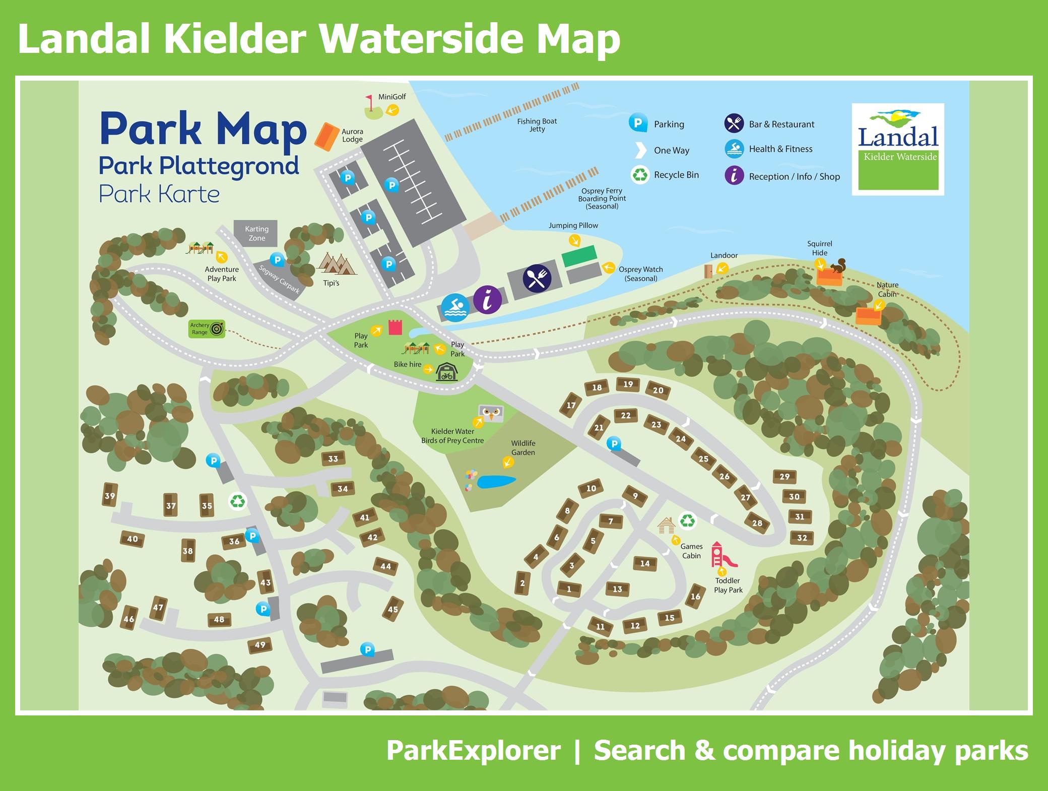
Landal Kielder Waterside is located near Hexham, on England's largest reservoir and in the middle of Kielder Forest, the country's largest forest. The layout of the park combines woodland, hills and the lakeshore, with the lodges set amid the greenery so you step straight from your accommodation into nature. The park map and site plan show the location of accommodations and facilities: the indoor pool, the fitness area, the onsite restaurants and bar serving fresh, locally sourced food and drink, the supermarket, mini golf, the outdoor playground and an activity programme that includes archery and Segway. You can choose from cottages and chalets for 4 to 6 people with two or three bedrooms. Tip: if you want a view of the water, look for a lakeside spot when booking; if swimming and dining are your priorities, stay closer to the central facilities. You can go sailing on the lake, and in the evening admire the night sky in this Dark Sky region, for example at Kielder Observatory.